Here is a timeline of significant events and circumstances with the Dewdney Trail since its completion in the fall of 1865.
1865-1898 – Dewdney Trail was the main east-west link between Kettle Valley and Columbia Valley.
 1905 – West Kootenay Power and Light built a transmission line west of Rossland, using parts of the Dewdney Trail for their access road and right-of-way.
Early 1920s – Cascade Highway built between Christina Lake and Rossland. The new road crossed the Dewdney Trail many times, but did not follow it for any distance. Dewdney Trail continued to be used by local ranchers and farmers for moving their cattle and as a horse trail, while the Cascade Highway became important for larger conveyances.
1949 – Completion of Hope-Princeton Highway
1962 – Highway between Christina Lake and Castlegar completed.
Oct. 13, 1963—Ribbon-cutting for Salmo-Creston Highway.
1972 – B.C. Parks Branch did a reconnaissance of the Christina Lake to Patterson portion of the trail and found that 70% of the original trail was still intact.
1972-1975 – Parks Branch in cooperation with the Forest Service works to restore Dewdney Trail section between Christina Lake and Paterson, including interviews with old-timers.
Mid-1970s – archaeological study done on portion of the Dewdney Trail between Grand Forks and Christina Lake by M. Friesinger.
Late 1970s – B.C. Highway installed lines parallel to the West Kootenay Power line, but on a grander scale.
 1985 – A forest fire burned over the 2 km section of the Dewdney Trail along the Wild Horse River, which was the best-preserved section of the trail in the East Kootenays.
1989 – Corridor Plan for the Dewdney Trail produced under the Recreation Corridors program.
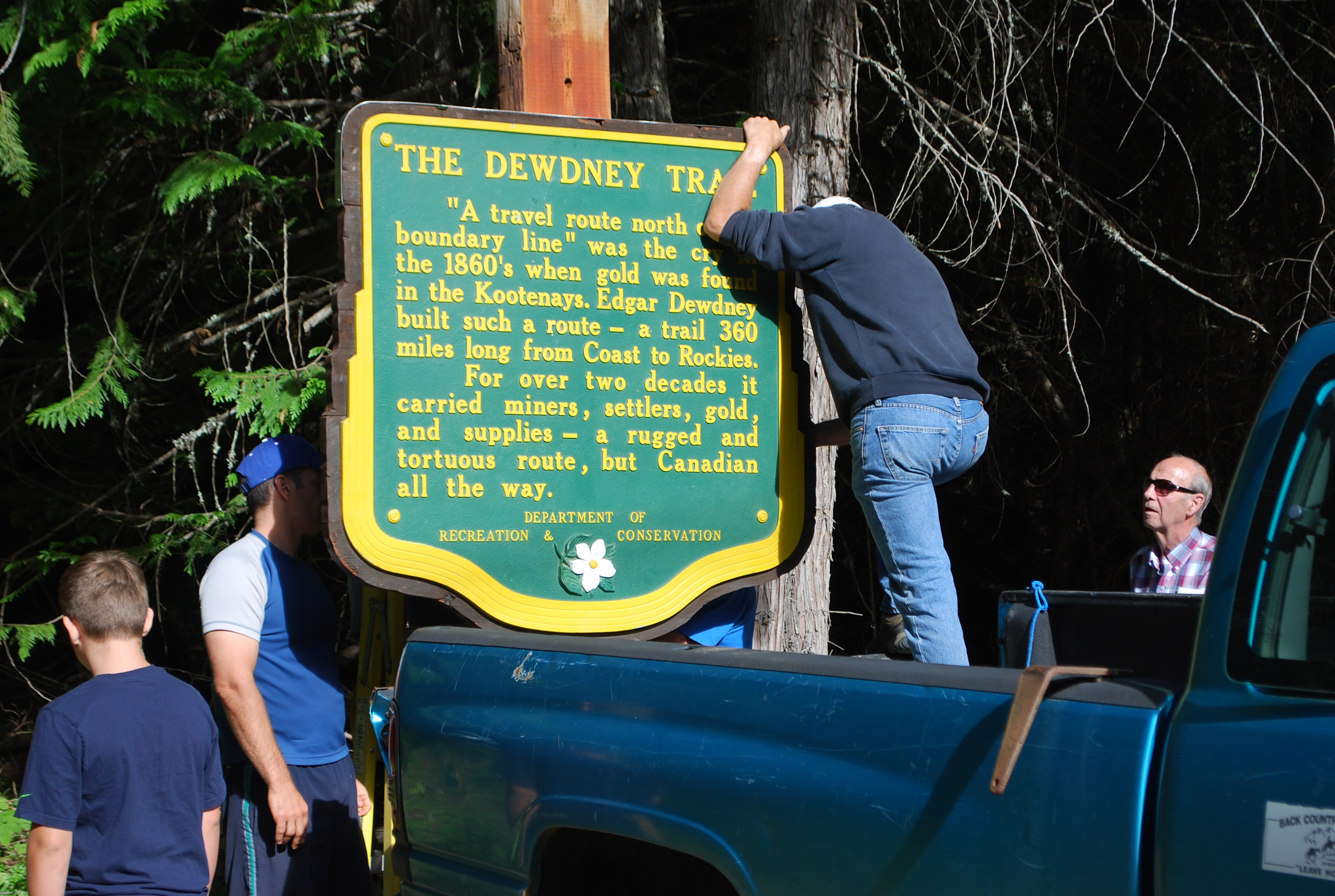
April 10, 1991 – Portions of the Dewdney Trail were designated as a Historic Site by provincial Order-In-Council. Designated portions on Crown Land along the Wild Horse River; near the headwaters of Summit Creek and down to the Kootenay River; and from the Rossland Summit (Record Ridge – Mount Sophia Pass) to Christina Creek.
May 24, 1995 – Memorandum of Agreement on Heritage Trail was signed by the Ministry of Forests and the Ministry of Small Business, Tourism and Culture. The trail has also been designated as a forest recreation trail under the Forest Practices Code of B.C., and as an Archealogical Site under the Heritage Conservation Act.
March 1996 – Dewdney Trail Management Plan for Trail Portions on Public Forest Lands in the Nelson Forest Region published and distributed. The Dewdney Trail Corridor is considered to be 100 meters on either side of the trail centerline.
October 1996 – In line with the Management Plan, the Ministry of Forests commences a procedure of Alteration Permits established under the Heritage Conservation Act, including rehabilitation measures for disturbed parts of the trail.
September 1998 – Mapping and assessment conducted by Champion Contracting for the Forest Service on sections of the Dewdney Trail, including the Santa Rosa Summit, Santa Rosa Creek, Big Sheep Creek to Corral Creek, Corral Creek to Cascade Summit, Cascade Highway Summit, Lost Creek,
 1999 – Location of the trail is plotted using a GPS unit. The GPS plot corresponds to the location found by B.C. Parks in 1972.
September 2015 – incorporation of the Dewdney Trail Heritage Society, focusing on protection and preservation of the section of the Dewdney Trail between Christina Lake and Rossland.
